(As ever, please click twice on the images to see them full size)
 Monsal Dale viaduct over the River Wye seen from Monsal Head
The railway not only gave the Midland its direct route to Manchester, it hosted fast London expreses late into in BR days in the 1960s. It was also a major freight artery especially following the demise of the Lancashire coalfield in the inter-war years requiring coal to be brought across the Pennines from the East Midlands. In its last years it was the route of the iconic 'Blue Pullman', more prosaically known as the Midland Pullman which provided a fast and luxurious service between Manchester Central and London St Pancras. However, as perhaps a delayed result of the 'Beeching cuts' of the early 1960s, the line was closed by British Rail in 1968 once the Manchester to London Euston via Crewe electrification was completed.
In 1981 the Peak District National Park Authority opened much of the track bed as a walkway and cycleway, but the six tunnels remained closed making cycling the route somewhat impractical, and causing most walkers to prefer the uninterrupted and quite beautiful if meandering and sometimes muddy walk along the valley bottom alongside the River Wye.
In May 2011 the tunnels, having been illuminated along their lengths, were opened to the public principally to provide an uninterrupted 8.5 mile cycle route from east of Bakewell to Blackwell Mill in Wyedale. Here the original rail route split at a triangular junction, the Midland main line turning north through Great Rocks Dale (the scene today of much quarrying) to Chinley and on to Manchester, while a branch continued straight ahead up the Wye Valley to Buxton, joined by the third arm of the triangle from Great Rocks Dale towards Buxton. The route to Buxton from Great Rocks Dale is still in use by stone trains, as is the erstwhile Midland main line north from Great Rocks Dale to Chinley and beyond.
 Diagram of the railway topology today (please click on the image to enlarge it)
 Map of the Monsal Trail (please click on the image to enlarge it)
It was time to try this trail for ourselves, so today Peter de la Wyche and myself loaded our bikes into Peter's car and headed for Millers Dale.
 Peter, with his bike, my bike, and his car
at the former Millers Dale station this morning
We headed east from Millers Dale and found the trail's surface to be smooth and well made. The southern of the twin viaducts at Millers Dale is the one used by the trail; we crossed this and soon came to our first tunnel, Litton Tunnel, closely followed by our second, Cressbrook Tunnel. All the tunnels on the trail are spacious and dry, and all but the short Chee Tor no.2 and Rusher cutting tunnels are lit by a row of electric lights hung from the crown of the roof in a line. Providing power for the lights involved running a low-voltage cable to Chee Tor No.1 Tunnel from the former station at Millers Dale, about half-a-mile away, whilst the other three are supplied via a transformer sited at Monsal Halt, tapping into an existing power source there. Nonetheless the tunnels seem dark as you plunge into them from the sunlight as the sooty walls absorb any light thrown at them, and many are curved so you can't see the far end. They are also quite cold compared to the warm sunny day outside, often with a cool breeze blowing through them.
 Despite being illuminated, the tunnels can seem quite gloomy on a sunny day
This section of the trail emerges from tunnel straight out onto a ledge high over the Wye Valley, then plunges into tunnel again. At Monsal Head the Wye is crossed at the apex of a 180 degree meander in the river by the superb Monsal Dale viaduct. Beyond the viaduct the trail plunges immediately into Headstone Tunnel in the cliff face below Monsal Head.
 Peter rests on Monsal Viaduct. Ahead, the trail plunges into
Headstone Tunnel in the cliff face below Monsal head
 Looking down onto the peaceful Wye from Monsal Viaduct
One emerges from Headstone Tunnel into far less dramatic scenery, as we have now left the Wye Valley and are passing undulating fields to the pretty little station of Great Longstone.
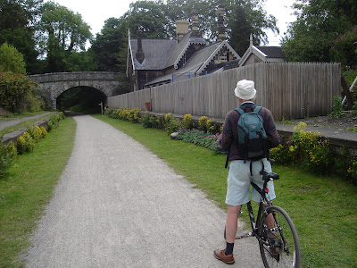 Great Longstone station. Presumably the station building is fenced off
from the platform as it is now a private house.
 Despite being illuminated, the tunnels can seem quite gloomy on a sunny day
This section of the trail emerges from tunnel straight out onto a ledge high over the Wye Valley, then plunges into tunnel again. At Monsal Head the Wye is crossed at the apex of a 180 degree meander in the river by the superb Monsal Dale viaduct. Beyond the viaduct the trail plunges immediately into Headstone Tunnel in the cliff face below Monsal Head.
 Peter rests on Monsal Viaduct. Ahead, the trail plunges into
 Headstone Tunnel in the cliff face below Monsal head
 Looking down onto the peaceful Wye from Monsal Viaduct
One emerges from Headstone Tunnel into far less dramatic scenery, as we have now left the Wye Valley and are passing undulating fields to the pretty little station of Great Longstone.
 Great Longstone station. Presumably the station building is fenced off
from the platform as it is now a private house.
 We pressed on past Hassop and Bakewell to the end of the trail at Coombs Road viaduct, then turned around and rode back the other way
 Our bikes at the former Bakewell station, where we stopped for a break
 We stopped for a while at Hassop, where the station has been converted into a cafe and bookshop. We browsed the shelves of the later, though if we come again I might be tempted to have lunch here as the cafe looked good (we had brought sandwiches with us today).
  Back at Great Longstone station, we had lunch on these steps, leading to nearby Thornbridge Hall. When the hall was built it was owned by Midland Railway director George Marples, and this was his private access to 'his' part of the station platform.
 Between the Litton and Cressbrook tunnels is a few hundred yards of track bed built on a man-made ledge in the valley side. It afforded train travellers a snapshot view, but possibly the finest on the line, down into Water-Cum-Jolly-Dale. Unfortunately today the view is largely obscured by tree growth, a scourge of the modern railway as well as of former lines like this one.
 Millers Dale again, with a view of the newer northern viaduct from the
original southern one, which today carries the trail
 Looking over the southern side of Millers Dale viaduct
 Me and my bike on Millers Dale viaduct
 Millers Dale station from the trail. Back now at our start point, we carried on past here to the western end of the trail at Wyedale.
 West from Millers Dale took us through Chee Tor tunnels one and two, and Rusher Cutting Tunnel, through Chee Dale to Wyedale and the trail's western end. We are now on the 'bottom arm' of the triangular junction referred to above and the route used to continue straight ahead along the Wye Valley to Buxton and beyond.
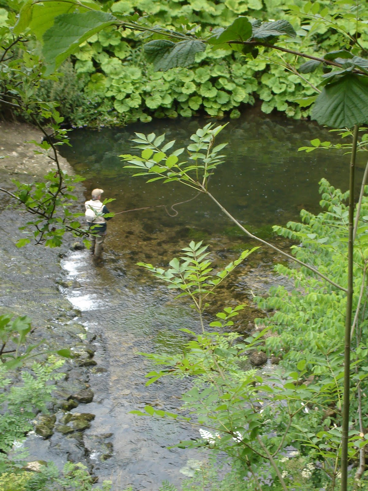 Looking down to the river from the end of the trail, we see someone enjoying a bit of fly fishing
 Just before the end of the trail the track bed of the former midland main line up to Great Rocks Dale (the eastern arm of the triangle junction) branches off to the north. This is today part of the Pennine Bridleway and we cycled back to that junction (the eastern-most on the triangle) and followed what was the original Midland main line as far as we could (see picture above). From here it used to continue ahead curving round to the right into Great Rocks Dale and on to Chinley and Manchester. On the extreme left of the picture the trees indicate the Monsal Trail proper, the 'bottom' arm of the triangle, that line continuing straight ahead to Buxton. Below the trees on the horizon straight ahead is the final, western arm of the triangle. That is still in use by stone trains and connects Great Rocks Dale to Buxton.
 Looking back from the point above, towards Millers Dale, which we are about to ride to get back to where we left Peter's car.
The Monsal Trail is an excellent facility, and I strongly recommend it to all cyclists. The original railway rose almost 600 feet between Rowsley and Buxton though it does undulate a bit, so riding from west to east is easier than east to west. Walking it is also quite possible of course, but as with most disused railways progress on foot would, I should think, seem frustratingly slow!